Two things have come up that prompted me to reach out again.
1) I’m moving forward on the Cluster Ballooning project. If you have not read my last few entries, you had better get up to speed. If you would like to follow along, go to the new blog thing – or whatever you call it: Lawn Chair Pilots. Way better if you sign up to follow, as the action will come in major spurts. Not likely to use this blog again.
2) I am putting my Most Excellent PCT Adventure into a single document. Basically this journal, the missing photos, all the drafts I never published, more of the characters and musings, the equipment list for you nerds, plus maybe one or two spelling and grammar corrections. Right now it’s at 400 pages, mostly photos. I’ll make it freely available via download or on a CD. The only tricks are: how are you going to find me or know when it’s ready?
We have a Facebook page for the Next Big Adventure: Lawn Chair Pilots. Facebook for an Old Guy, can you believe it! Never thought you’d see that happen, did you?
Joe – no longer Yeti – I’ve gained back 8 lbs- B.
Final post here, just to close up this adventure and invite you to join me on the next.
I got to Trail Angels extraordinaire The Dinsmore’s, also known as Hiker’s Heaven. Weather at that elevation wasn’t so bad. I called my wife from the car that did take a chance and picked up the rain drenched trail trash at Stevens Pass, and started to explain that I’ve decided to quit. It was a tough decision, and even harder to verbalize. Learned from her that my resupply package, a new phone and a GPS from Alex (remember Alex?) were waiting for me. She had gone through a lot of trouble to make that happen, so I felt quite guilty about failing to meet expectations. I was thinking maybe I could keep on going, at least for the next section.
When I got to the Dinsmore’s, the first thing I did was to eat, then eat, then eat some more. I had used up my food ahead of schedule. Even though I finished a half day early, I was out of food. The cold just required more calories. I polished off what was left over from dinner (maybe 1500 calories) and Andrea pulled out another big bowl of spaghetti and meatballs. Probably enough for 6 normal people, and I ate 3/4’s of it. There were 3 other hikers there, and they were impressed with how much I was shoveling into my face. If you can impress a thru hiker, you know you’re eating a lot. I looked like a scarecrow with a hollow leg. Andrea: Bless your heart and your freezer.
The other thing I got was a weather update. Snow down to 3,000 feet, temperatures at night below freezing. Non stop storm for 5 days, minimum. One by one the risk factors were adding up. 123 miles with no cell phone service, 15 – 24″ of snow at the higher elevations, no easy exit routes etc. If I was still with Alex and Dan I might have still considered it. But even I, Mr. Eternal Optimism, Mr. Think Positive, I-Can-Do-It, had to face facts when they land on your head like a ton of bricks. Jerry and Andrea Dinsmore were cool about it, but I know they were relieved when I pulled the plug for sure. They did not want to see any of their temporarily adopted children go out in weather like this.
So the adventure ended with a ride to Everett, bus to Seattle, then train to Vancouver. End of story. In a relative blink of an eye, back to the real world.
This brings us to the beginning of the next story.
If you have ever done a long hike, or anything like this, you will recognize this: You have plenty of time to think. Your heart is pumping oxygen at about 100 beats per minute, but your brain is in neutral. Plenty of time to wander and wonder. Past could have been’s, should have been’s, future possibilities, etc. Probably the most often theme was “..If I was President..”, or as my mother used to say “..If I was Dictator..”. After solving most of the world’s problems several times over, I kept gravitating back to an idea that captured my imagination 30 years ago.
In 1982, Larry Walters, later known as Lawn Chair Larry, decided he want to listen to a ball game in style. He rigged 45 helium balloons to a lawn chair, took a 6-pack of beer and a radio and tied himself off on a 200 foot tether. His idea was to just float over his back yard and listen to the game. A good plan, until the tether broke, and he drifted into LAX airspace, into history and into the imagination of a young engineer working his first job in Vancouver, WA, yours truly.
I was totally captivated by the idea. The next day I rushed to tell all my new engineering buddies what a great idea this was, how we could improve on it (engineers are like that), etc. Almost universally they thought it was the dumbest idea ever. I of course was not deterred. I immediately dove in head and heart first. Wrote the ballast equations, researched atmosphere (pressure and temperature versus altitude), etc. All you really need to know is P*V=M*R’*T and go from there. Any questions so far? I even joined the Balloon Federation of America and the Lighter Than Air Society. My idea at the time was that there really was no limit, (a common fallacy among the young and enthusiastic) and why not try for a around the globe flight?
Eventually good engineering did uncover a few flaws in that plan, but it never left my heart. Perhaps I never should have seen the movie The Bucket List, but back on the trail this, plus a million other ideas resurfaced. Only this one stuck. The difference now is I know a lot more about control systems, have available computer science friends, and have a better feel for what is practical versus just what is possible. I think I’ve solved the biggest technical hurdle -maintaining a constant altitude in an unstable buoyancy environment. As any scuba diver knows, if you start to sink, you will only sink faster and faster. If you start to rise, you will only rise faster and faster unless you can control buoyancy. Air and Water are both fluids, so the basic equations, limitations and challenges are the same. We can do this, and I’ll get to your part shortly.
One of the challenges is creating an ultra light mini environment in the cold. The whole PCT thing is a good training ground for this. The constraints are different, but the principles are the same. 1 gram of dead weight requires approx. 1 liter of helium. Remember this fact; there will be a quiz later.
In short, here is the plan and schedule:
The ultimate objective is to set the world’s long distance record for lawn chair ballooning. And yes, this is a real category of flight. It is covered under FAA Regulations Part 103, the same regulations that cover ultra-lights and hang gliders. All perfectly legal if you can keep under an 18,000 foot ceiling.
The “Lawn Chair” category is a throw back to Larry. The general term for this subdivision of aviation is better described as “Cluster Ballooning”. For those of you who might be initially skeptical, and not surprisingly my wife is currently in this category, I offer this challenge. Spend just 20 minutes bouncing around the internet researching “Cluster Balloons”. People have crossed the English Channel, gone as high as 20,000 feet, as far as 1,600 miles, one guy has flown in 46 out of 50 States, etc. This is not just one crazy idiot; there are lots of enthusiasts and practitioners. If after 20 minutes you come away with the impression that it is just is not practical, than OK, you’re off the team. If however you think, “Well, it may not be for me, but I think it’s OK for someone else to try…”, then welcome aboard. Just don’t let those occasional “ ..and then he drifted out to sea and was never heard from again..” stories deter you. We can solve that. We have technology and a Daisy Red Rider BB gun at our disposal.
January 2013 Team Development and specific engineering task assignments
February 2013 First tethered flight with a Dummy (go ahead, make the obvious Dummy reference). Main objective is to prove some of the basic control parameters and provide a platform to generate interest. Expectation is that we can use the internet to raise funds (helium is the only expensive component). We need video.
March 19th: St. Joseph’s Day and the day I started the PCT – First free flight over rural Clark County. Mostly low level: 1,200 – 3,000 feet AGL. Prove we can maintain constant altitude and the safety altitude limiters work.
June 21st. Summer Solstice – longest day of the year and my 60th birthday. Fly sun up to sun down. Use completely automated flight controls, oxygen system, communication systems, etc. All major technical components demonstrated.
Sometime later in 2013: When the jet stream is most favorable, attempt the long distance flight. Current thinking is 3 – 5 days duration.
It’s as simple as that. You in? I thought so. Since this is my last post via this vehicle, the way to keep in touch is to send me your email address to: barberaj@tds.net I’ll set up a web page to capture progress (or lack thereof) as things develop. I promise you, if nothing else, it will be entertaining. In addition, it takes about 20 – 30 people for a ground crew for a major launch, plus a chase vehicle. This is where you come in.
And if I don’t hear from you, Happy Trails.
Yeti.
Some Scenes on and off the trail
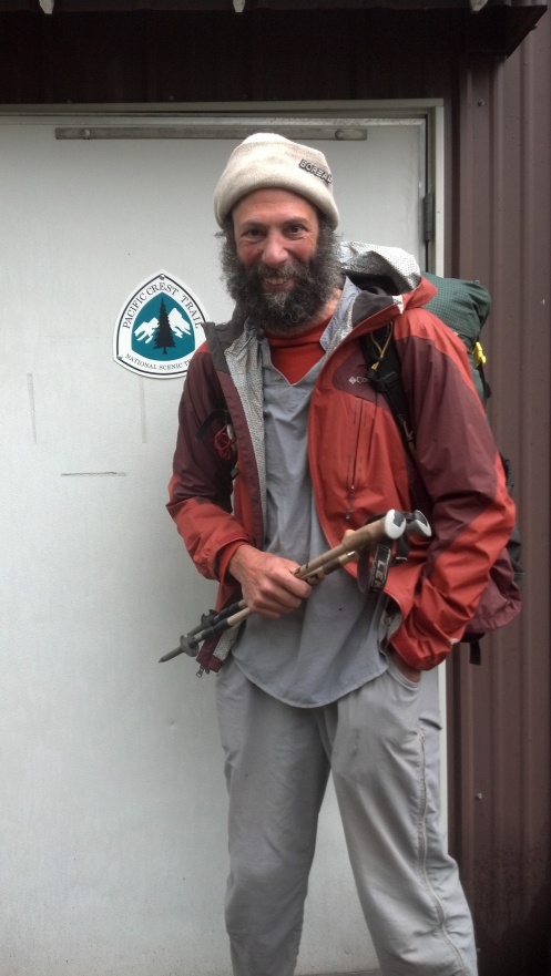
Last photo of me in hiker garb. I’m not sure who I’ll be next, but I’ll never be exactly this guy again.
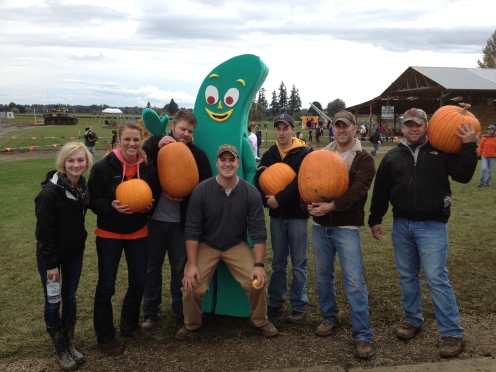
Just two days later, back in the real world. That’s me in the Gumby suit. 2nd from left is my favorite daughter. Barely visible in the background is the pumpkin cannon that Quartermaster Russell and I built.
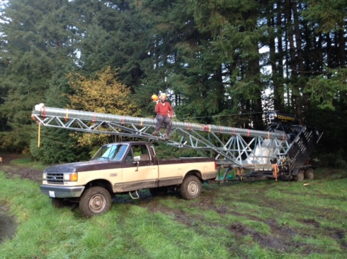
Better shot of our Pumpkin Cannon, named Furthur (an obscure literary reference). For this we qualified for honorary degrees in Redneck Engineering. Our motto:
Been There, Broke That.
“..but someone must have mistaken me for Noah.” Quote taped to Debra’s refrigerator.
I depart the Summit Inn at Snoqualmie Pass once again, on what will turn out to be my last section for this season. Everything wrapped in second hand plastic except my spirits, which are soaring to be back on the trail again, rain notwithstanding. This time I take the traditional route, not the ill fated hot springs alternative. No phone, no GPS, no camera. Just one objective: North, to Canada.
At the last trail head I saw for the first time a warning about Grizzly bears besides the usual description of Black bears. Also a hand written note about a black bear sighting near such and such a campsite. At this trail head ( only a mile or so East) there is also the first warning I see about Mountain Goats. And the fact that September- December is a particularly dangerous time to meet a male goat on the trail. This is truly remote and wild country. I see neither. At almost 6′ 3″ and only 154 lbs I would look like a walking stick of pepperoni to a bear. And thanks to Fritz’s homemade goose pepperoni that I’ve been packing, I probably smell like one as well. Not sure what a goat would think. If he could read my mind, he’d probably realize we had more in common than might be first imagined.
This is a popular section for day hikers. It’s Sunday, and as I am heading uphill and away I meet several small groups returning and one serious long distance runner. All are cheerful and seem unaffected by the constant rain. They’re just happy to be out there. Except one guy, whose only greeting is “How far is it to the parking lot?” I lie and tell him he’s close.
I get maybe 5 or so miles the first afternoon and find a good camping site under some large trees. I set up in the last daylight, being as deliberate as I can in keeping everything dry. The transition between all packed up and being all secure in the tent is a prime time to get things wet. I’ve learned some things since the last adventure, so I am more deliberate in how I pack and unpack.
Not that it helps much. First in the generic problem of the tent walls being wet with condensation. My sleeping bag constantly rubs against the ends where the tent narrows down. Each night my head and foot ends get wetter and wetter. Not a good thing for a down bag. In addition, I experience a new phenomenon. I have the tent lines taut to protect against the wind. A gentle rain creates a gentle, comforting background sound, like sleeping next to a river or near the ocean waves. When the wind changes and I get a direct blast of hard rain, and it’s like living inside a snare drum. Worst is the big, random drops from the tree branches. This irregular base beat is both loud and disturbing, especially since my head is near the tent ceiling. Sounds like I have my head in a bucket and every now and then someone is beating the bucket with a stick. Even worse is the effect that the big drops have on the condensation. Each one sends a fine mist of water spraying inside the tent. 90% of it lands on the bag, so it gets wetter by the hour. 1% or so explodes right into my face, and the remainder gets distributed among my already wet processions.
Learning from last time, I leave more outside the tent to reduce condensation, but it does not seem to help much.
Up at dawn, which is getting later and later every day, I put on wet underwear, wet pants, wet shirt, and for the last time dry socks into wet and cold shoes. Not so bad, I can do this. And then I just start walking. Rain off and on all day. No time to stop and dry stuff out, even if the weather had cooperated. I have no maps for the first two days. I discarded them when the plan was to take the hot springs alternative. As per usual, I hike until dusk and look for a place to camp. And then I hike well into darkness, still looking for a place to camp. Then I headlamp up and continue to hike and look for a place to camp. This goes on for about 2 hours or more after full on dark until I top out on some ridge and find a spot. Good news / bad news camp.
On the plus side, I estimate I’ve covered 27 – 28 miles, beating my previous one day record of 26.2 miles. It’s raining hard but the winds are calm when I set up, but that changes during the night. I set up with the narrow ends of the tent into the prevailing winds and get into my damp but pretty much OK bag and sleeping wools. It takes the only two pairs of dry socks I have left to keep my feet warm, but I’m still OK. Inside the bag I am also wearing my down jacket and two hats. During the night, every now and again the wind shifts and I get a cold blast broadside. This really rattles my little shelter, but I’m too exhausted to really care. Until the first tent stake blows out from the cross wind. I take my socks off to protect them and re-secure it, adding a small log to add weight.
As per usual, I’m up and poke out of the tent several times during the night. One time I see that the hail has piled up on the cross wind side. Next time up, the world is white with a frosting of snow. Next time my universe is blanketed in white. Snow builds up and causes one end of the tent to start to collapse under the weight. I kick it off from the inside, causing a shower of condensation inside and blowing out a corner stake in the process. I’m working on a “..not perfect but I can live with it plan..” when the wind kicks in again and blows out the neighboring tent stake. No choice but to go out bare foot in the snow and reset them.
As you might imagine, since I don’t employ a ghost writer, I survive the night to go through the putting on the cold wet underwear, etc. ritual again. This time with wet socks to complete the experience. Maybe 1 – 3″ of snow, depending on how sheltered any section of trail it, I hike on. I look across the valleys can see the snow disappears at lower elevations, so I am not too discouraged. And I have a plan.
At this point I am less than halfway into this section and can still turn around. Yesterday’s plan was: a) hike all day and camp. b) decide in the morning to go on or turn around. Thinking was that after a full day plus the first day’s 5 miles I could turn around get out without having to camp again. But with the yesterday’s long march I could not get out without camping again. I would have to camp at least once. If I did the same mileage going North, I would be more than halfway through at day’s end, so the equation is now biased towards continuing on. It would have to be pretty bad to justify turning around. I get to the trail conflicted. After two nights my stuff is already pretty wet and will only get wetter. Consider the fact that I am a weenie and don’t want to be cold or wet, and more specifically, a great big weenie and don’t want to be cold AND wet. I take a few tentative steps North trying to decide. I am walking in ankle deep snow in what are not much more than wet tennis shoes. It is cold so I start walking faster trying to warm up. By default, by not deciding I decide. North it is.
Just a few hundred yards up the trail I come to a junction where the PCT takes off at a right angle to the left. I surely would have missed this at night, so I take it as a good sign. I continue on, mostly going downhill. Snow gets deeper rather than lighter as it has collected on the lee side of this mountain.
By mid day I am back on the map again, which buoys my spirits. Except the next thing on the map is a river ford. Nothing to do but cowboy up and plunge in. The few days of rain has certainly increased the river flow, but I can see by the banks this is nothing compared to the snow melt season. About knee deep, the river is running fast but surprisingly not as cold as I imagined. This is the first of several fords in this section, and at all I come away with the same experience. Does not seem so cold at first, but just a few minutes later I am cold right down to the very core of my being.
I go on for a few more hours, the trail often as much of a small creek as it is a pathway. When I started in the desert, the advice was to change socks three times per day so your feet will stay dry. Wet feet are more likely to blister. My feet look like prunes, and have been that way since Sunday. They are now more robust than at any time on the trail. I love my feet and tell them so several times throughout the day.
At some point I realize I must have missed a turn. I go through the usual “..I go just a little further and then turn around..” ritual several times, until I am discouraged. Once again I dive off that mental cliff and say ” …enough is enough, I am just going to follow this trail. It will come out somewhere and I’ll just bail out..” I’ve mentally given up once again. If you’re thinking I’m being a wimp, you would be correct. I’m heading who knows where along some unknown trail when I see the first person in two days. A deer hunter with a good map, and he knows how to use it. Together we work backward to the missed junction. When we come across it, it’s as big and well marked as a freeway exit. With my hood pull in tight against the wind blown rain I just never saw it.
My reward for being back on the correct trail is another river ford. A little deeper than the last, wider, but not as fast. Just as wet and just as cold. It’s getting late now, and I’m thinking I’ll camp soon. I’m working my way uphill when the weather changes again. It’s been raining, but really not all that cold or windy, until now. The temperature drops considerably in only a half hour or so and it starts to snow again. On top of this, I seem unusually tired and I start to stumble more often. And then I start to sweat. My inner clothes are soaked in just a few minutes and I realize I am having a full blown hypoglycemia (extreme low blood sugar) episode.
My trusty (not) blood sugar monitor says I’m high at 169, not the less than 55 the symptoms indicate. I am out of readily available food in my waist belt, and would have to unpack my safe and secure food to get something to eat. I am hesitant to do this because suddenly I am so cold and now my inner clothes are wet. I don’t want to stop until I gets some shelter, so I try to march on. All of you amateur endocrinologists are probably screaming at me for being so stupid, but you had to be there. Finally I am so tired I just sit down where I am in the wind and snow and dig into my pack. All I want to do is close my eyes and go to sleep. I try to rest but can’t. The food helps, but I have a second, less severe episode just a little while later. This time the meter says 219, indicating blood sugar way too high. Had I taken the insulin that number suggested, I would probably have been dead in an hour. Being a former pilot, I’ve long held on to the philosophy of “when in doubt, trust your instruments”. Actually, I was never that good of a pilot, and am now happy to have broken that golden rule.
On the strength of pure stubbornness, I am able to continue. On to a good camp site would be ideal, but there is a sliding scale running from “good”, straight through “good enough” all the way to “I don’t care anymore”. You can imagine which end of the scale I’m working on when I get to a too narrow, too rocky, slanted in two directions spot on the trail where I just stop. Not another step today, I’ve had it.
Now had I been paying $400 a night to stay at the Ritz I might have complained about these accommodations, but not tonight. There isn’t anybody to complain to anyway, neither bear nor goat, just my constant companions, wind and rain. I do hike back a bit to get water and eat enough to satiate your average high school football team, coaches and cheerleaders included. I have to put my olive oil into my underwear oven to get it warm enough to pour, but I am dry (well, more like just damp, not wet) and food makes me happy. Remember, all things are relative. The only positive thing I accomplish besides getting safe is to go over the next day’s maps and realize I missed another trail junction. With this final thought of the day, I go to sleep for 12 hours straight.
Just a little more snow by morning, no big deal. What to do, go back to find the trail junction, or is it just ahead a bit? I have little faith in my ability to estimate how far I’ve come from the last river ford, and I am deep in the trees along a steep ridge and can’t see anything to get a good fix on my position. I give myself 15 minutes (1/2 mile) and then I’ll turn around, and then another 15 minutes, and then arrive at the familiar junction of “turn around, stupid” and “this is stupid, I’ll just follow this trail out, it has to come out somewhere..” Again, I just march on. Going back, no matter how much it makes sense, just does not seem to be in my nature. The sign of a great leader, or symptomatic of a person destined to die alone, lost in the forest?
Again, the Trail Gods are with me. In my semi-delirium yesterday I went much further than I realized. Also, the last trail junction was only a marker, not a turn. In less than an hour, I am at the next junction, on track and ahead of schedule. The sun makes a sudden cameo appearance. Not a stellar performance, but playing to an appreciative audience. The snow is deeper, but the trail immediately starts downhill steeply. Life is good, until I step on one of those small logs used to divert water off of the trail. I go down hard, banging my elbow and hip. I lie there for a moment, thinking for about the hundredth time, “this could be it”. The last time I smashed my elbow, it was hard enough to draw blood through my shirt. This time it is my hip that takes the brunt of the force. E=1/2 M V squared and all that. I have my insurance card with me, but no one to show it too. Drive on, Ranger.
I don’t have many recollections of this day’s hiking, besides walking with a limp and almost losing my precious hat. I had taken it off and tucked it under my waist belt. I come across yet another river ford, this one necessitated because previous snows tore out the bridge. This one narrow but fast, I again loosen up my pack and pole straps. Again, five minutes later the cold hits me and I reach for the hat. Not there. It must have dropped when I unbuckled the waist belt. Nothing else to do but go back and re-cross the river and try and find it. I go back but it is not on the far bank, so I’m thinking it much have gone down stream. I’m just about to abandon it (another chink in my thermal armor) when I find it in the mud and water on this side of the river. Somehow it stayed stuck to me throughout the river crossing, giving up its grip only on the climb up the opposite bank. I say nice things to it and dry it out the best I can.
At about dusk I get to a valley. Much lower in elevation but now the snow is deeper. For the first time I start to lose the trail. It only takes 6 inches or so of snow and the trail just disappears. On the ridges and side slopes you can get the sense of the trail by the cuts in rocks and vegetation, but not so on the flats. It’s getting dark. I keep backing up a few steps and then restarting. This works as long as you can look forward to some disturbance in the elevation, but with the fading light it becomes more difficult. My plan for the day was to get within 20 miles or less of the trail ending so I can get out with only one last camp. I push on the best I can and get to within 16 miles from the exit. 16 miles of unknown trail, under unknown conditions, but well with range if all goes well. I should be out before dark tomorrow if nothing major goes wrong.
I’m halted by lack of daylight and clear trail definition. I’d rather camp short than risk going off in the wrong direction. I find a beautiful camping spot, a tiny spot of a meadow surrounded by but not covered by large trees. Actually, it is really a terrible place to camp, sloped, rocky and full of brush and branches. But the deep snow hides all this, and it looks like a picture postcard of the ideal camp spot. I stamp out a flat spot, filling in and kicking out as required and camping on top of the snow. This is Last Camp, and I already know it.
In the fading daylight the sky is filled by approaching Alto Cumulus clouds. Back to the pilot days, I know what this means. They are the advance team for an approaching low pressure front. More rain and snow on the way. Back in the day, I would have known I could out run them in my trusty rental Cessna 150. Here, in my trusty size 13 Wide hiking shoes, I’ve got less than 24 hours before the snow hits the fan. I’m done for. There may be a small window of “good” weather left, then that is it for days. Already I’m marginal on being able to navigate. Two more inches of snow would wipe out most of the trail, and I’m guessing there is 6 – 12″ on the way, more at higher elevations.
So I’ve resigned myself to Last Camp. which includes the Last Dinner (not to be confused with the Last Supper). I have three dinner meals to chose from, of which I will eat two. I’ll reserve one just in case. In most cases I exit with one reserve meal and discard it. Usually the lowly Macaroni and Cheese. Tonight I celebrate with it. Loyal, effective, simple, dependable. Like it’s cousin, the Top Ramen, the humblest are the Kings of the Trail. Best Calories/$ ratio, able to be mixed with anything. Truly Democratic in the best sense. (Other Democrats could earn a lot of respect by imitating trail food instead on trying to be a free banquet for All.) All hail the Mac and Cheese. I use all my extra’s for it. The last of the olive oil, protein powder, etc. I had what I thought was two packets of cheese from some pizza place, and I add those. Turns out one was a medium size pizza’s worth of red pepper, but I throw it in anyway. I eat this and more, including another Knorrs pasta and rice / broccoli and cheese meal, plus most of tomorrow’s trail food. The actual last meal is grits in the morning. For the first time in 7 months, I don’t wash my pot right after I eat. Last time I check the maps, last time I do this, last time I do that. Everything very deliberate. All very routine, all very ritualistic, all very melancholy.
I’m a failure. I won’t be able to finish the trail this year, I just know it. I had envisioned finishing the trail in snow shoes if I had to, like some modern day Grizzly Adams. What does I marathoner get if he only runs 24 out of 26 miles? Nothing. No tee shirt, no cheering crowds. Just sore feet and a long walk home.
I do take one big risk in the morning, and hike out wearing my dry sleeping wools and socks. If I don’t make it out today, I’m at risk for freezing at night. But I do, and cover the remaining 16 miles before dark. No one at the trail head to even take a last picture. The After picture, to compare with the Before shot taken at the Mexican border. 2,476 miles accomplished, but not the 2660 required. For what? It may take awhile to answer that.
Some Scenes from the trail:
A small lake tucked into a fold in the side of a mountain. This is the Alpine Lakes Wilderness. Characterized by small, high elevation lakes instead of large lakes in the valleys. Many look so remote they may go years without a human visitor.
Tracks in snow. Elk and deer for sure. What I believe to be a mountain lion, complete with the inverted M. A pair of odd tracks that look bird like in their delicateness but maybe 4″ long, following the trail for about a mile. Kind of like an inverted Peace symbol without the outer circle. One or the other going of trail now and then to visit something I cannot fathom, but just walking along like an animal, not a bird.
Snow covered tree tops poking up out of the lower elevation clouds, like weird hair follicles on a cotton candy scalp.
Tops of mountain ranges painted in snow, as if God only had a 6″ brush and only gave them one swipe each.
A hillside jumble of rocks, done up in three tone gray scale. Some facets pure white. Other dark in the low angle sun, others illuminated. If it was not for the occasional bit of vegetation to provide scale, it looks just like a scanning electron microscope photo of metal after a fatigue failure. (OK, not everyone would jump to that comparison).
Last camp, as I first approach it. Perfect little fairy home surrounded by sentential fir trees. Safe, secure, pure in its uniform whiteness.
Same camp, next morning. Defiled by only a few hours of human habitation. Snow stomped down, dirt kicked up, discarded coffee grounds and human waste strewn about. It is such a terrible sight in comparison. The only solace is that in a few days of rain or a few hours of snow, nature will heal it.
The first river ford. Water never ceasing. Alive and noisy. Powerful. How deep? How fast? How cold? The trail is clearly visible on the other side, so it is possible. But today? For me? Only one way to find out.
The precarious camp site right on the trail. If you saw the photo of how it looked in the morning light, you would never believe it was the best option at the edge of darkness.
The rain drenched hitch hiker at Steven’s Pass. Trail trash? Vagabond? Criminal looking for his next victim or running from his last? Better not stop. Better safe than sorry. No reason to get involved.
Dear Gentle Readers,
Thank you for being my Constant Companions throughout these journeys, the foot paths and mental excursions. Having you to talk to day by day has been an enormous help, even if you could not always hear my voice. In the next few days I’ll post one more time to summarize, and to invite you to join me on the next journey, whatever that may be.
Be well, do good work, and keep in touch.
Yeti.
Made it out Ok. Lots of drama but no trauma. Details to follow. Weather not looking good.
Remember the post about Mt. Laguna and almost being a frozen human Popsicle? Well, I have to admit I may have over dramatized a bit. I don’t think I have the words or phraseology to fully convey what I went through yesterday.
Started out easy enough. I spent much of Friday doing the last journal update, so I did not head out until late afternoon. The trail splits here, with one route going through Goldmyer Hot Springs. That’s the route I took, having it recommended by the SOBO hiker I met at the cabin. First 5 miles to Snow Lake were easy, a nice path and several day hikers. Snow Lake actually had a snow field right up to the water’s edge. Just at dusk I took the next trail junction as planned. Immediately the trail turned to crap. Very narrow, slippery rocks, over grown in many places and lots of blow downs. Cut the pace to about half and had to use the headlamp. This is obviously a lesser used path, and not maintained. It was so bad I was sure I was on the wrong trail, but the GPS confirmed it. Right trail or wrong, there is no place to turn back to, and surely there will be a campsite eventually. I can hear a river below me, and usually there is a campsite where the trail meets a river. I just keep keeping on.
This is my first day on the trail in serious rain, and I learn I’m not as prepared as a I think. The map is the first thing to get compromised by the rain. My phone / GPS starts to get flaky. Everything is touch screen driven, which does not work when either the screen or fingers are wet. (It works by sensing a change in capacitance, if you must know.) I’m in the Commonwealth Basin, where no camping is allowed. It’s still light out when I enter, so I figure that I’ll just hike on through and find a site on the other side. I hike what seems like forever trying to find a site. Give up on that and just look for a flat wide spot on the trail to camp. Well, there is nothing flat about this basin, and the trail is about half the width of the PCT, not being graded for horses. I go on for two hours. It is so slick I fall at least six times, and my poles save me at least a hundred. Each time its all slow motion and mostly no injuries. When I finally get back to civilization I find scrapes and bruises all over my fore arms. I tweak my knee once, thinking “this could be it”, but escape largely unharmed and not overly traumatized.
Finally I find a semi wide, semi flat spot by the base of an old growth fir and set up my first rain camp. I have a rain cover over my pack (first time I’ve used it) but the pack is completely wet, and the very bottom just soaked. My waterproof gloves were on the very bottom, and I wring water out of them like they were sponges. Most of the stuff is well packed so I’m still OK. The tree provides a rain shadow so I can keep things reasonably dry while I set. First to fail is my meter for checking blood sugar. Not the continuous monitor, but the more import finger stick meter. Luckily I have a spare. So far, so good.
I haven’t eaten much because I’ve been fighting the trail, and it’s been cold. The trail is too narrow to set up my stove outside under the awning, so I try to cook inside the tent. Don’t try this at home, I’m a professional. Actually not a real professional, as my lighter is wet and will not light. I have a bag of backup safety stuff, including matches. Since I don’t use it every day it drifts to the bottom of the pack, where it has been wet all day. The matches are damp so they won’t light either. I go to sleep exhausted and without dinner.
Another rain related adjustment. Normally when I have to pee at night I just open the flap, kneel outside on my sit pad and go. Now that does not work, as getting through the flap sends a mini shower onto my wool sleeping clothes, and where I kneel is already soaked. The adaptation is to pee into my water bottle while kneeling inside my sleeping bag. Worked well so far, but one of these nights it’s going to cause a mess.
Next morning I have to do one of the things I have been dreading, getting dressed into wet clothes. Nothing drys, it is 100% humidity outside, same inside plus condensation. I sleep with both my hats on, and put the lighter in between the two. It dries and lights in the morning. I eat yesterday’s dinner and today’s breakfast, so I am fortified and actually feeling upbeat about getting through the first night. I figure I’ll be at the hot springs by noon and can dry my stuff there. The foot of the down bag is wet from hitting the condensation soaked tent walls, and the down jack from being near the flap. Not good, but so far not so bad. I’ll have to do better, because each night it will only get worse.
I thrash on down the trail for several hours until I hit the next junction, Babcock Creek. The trail is all washed out. I find what I believe is the side trail I am supposed to take. It starts at the right spot and goes off in the right direction. There are no signs, except for one that says “Trail not maintained beyond this point”. I think that is some kind of sick joke, as certainly the trail has not been maintained up until that point. But it is definitely a trail and I’m thinking I’m about 20 minutes away from the hot springs. That’s when things slowly turn worse.
No hot springs, no nothing. I can’t see very far ahead because everything is all fogged in. Very eerie, very surreal. I keep thinking “It has to be just ahead”, but nothing. Finally I admit I am either on the wrong trail (unlikely as there is nothing else on the map and the compass confirms the overall direction) or I just plain missed some turn off. Phone gives up completely, now permanently stuck on the start up screen. No way I’m going back the way I came. Just too ugly.
In general, my number one rule when getting lost (I’ve had lots of practice) is to backtrack to a known point. Not today. New strategy is to just keep following this trail. It will eventually come out somewhere. The further I go on, the dumber this seems, but the less attractive turning around sounds. For all I know this is a 50 mile trail to nowhere. I’ve got shelter, food and fuel, so being lost is no worse than being on the PCT, so I just push on. Turns out this is a very impressive trail. It goes up and down the ridges surrounding the basin, catching several peaks along the way. But it just keeps getting steeper and more exposed. Overgrown wherever sun and water permit, and blow downs every so often. It seems I’m a million miles off trail. I can see this trail has not been used in awhile, and it is very likely my footprints are the last they will see until Spring (which could be August). I keep going up to each mountain top, hoping to find a Holiday Inn or Denny’s, only to find the trail takes a dip and then climbs something higher. And it is just amazing. So desolate and forbidden. Looking down all I can see is a few tree tops and some of the surrounding peaks, everything else drown in an ocean of clouds. I could be in the Alps, Himalayas, Andes, anywhere. I’m above the timberline and soon I start seeing snow patches. This makes me colder just looking at them. If I get hurt out here (something seeming more and more likely) it’s going to get bad fast. The next time I take a tumble, which I do from time to time, all I have to do is tweak something and I’m 30 minutes away from hypothermia. I’m soaked to the bone, in spite of just purchasing the best, most breathable rain gear I could find. Any serious slip would knock me a few feet off the trail, where I would be swallowed up by the vegetation. They may never find my body.
I think back to the guy who got his arm trapped by a falling rock. When he eventually had the idea that he could just cut it off, he felt immediately relived. He had a plan, he had some hope. I develop my own plan. If I go down, and can’t get a shelter up, I’m finished. For sure. And I’m only one slippery rock away at any point. My savior will be insulin. I’ll take a massive dose and pass out. End of story. I keep thinking about what message I could type out on my phone. Surely someone would check the final text messages. But my phone doesn’t work anyway.
This seems as other worldly as I have ever been. No pictures however, dead phone = dead camera. It would have been such an overwhelming positive experience if I had not developed this continuing sense of dread.
I’m wet, cold and tired. My arms and hands hurt from climbing. I eventually reach what seems like the seminal pass. Only it is super steep and all washed out. The trail just ends by pointing up to a ridge, through a gully of washed out rocks. If you are like 1% of my friends, you would be familiar with The Chute on Mt Hood, it is as steep as that but with no snow. It’s either go up or go back, so I’m in “I’d rather die trying” mode. Several times this day I think, “just keep going forward. If you die today, people will think you died doing what you love to do”. I start going up using my poles in the scree. As it gets steeper, I move to the wall and used one hand to grip the wall, one hand to push off with the pole. Then it takes two hands on the rock wall. I’m at the edge of my endurance, and this is about as exposed as I have ever been in my life. I’m reaching my finger tips into cracks like I was a real rock climber. And then progress just stops. It seems like there is no way up, and I am about to (begin to?) despair. If you knew me, you would know that despair is not a word I would use casually. Then off to my left I see a few feet of trail that has not been ravished by the rock slides, and up above that another few feet. This gives me a sense of where the trail at least once was, and confirms up is the way to go. I try to traverse, grabbing the biggest rocks I can find for support. Rick: Remember that big rock you rolled onto yourself on our last big hike? It’s like that all over again. The bigger the rock, the slower it rolls. By what miracle they don’t take them with me I can’t say, but apparently I have more than 9 lives.
I finally make it to the top, feeling like I conquered the world. In reality, a thousand day hikers will do this in the summer, some wearing flip flops. No Holiday Inn, just the trail going off in four directions. One I discount as being just a short sprint to a peak to my left, one only slightly used straight ahead, and the main path to the right, going of course uphill. Still thinking this has to end somewhere, I go that way for quite a while until I find it ends at a spectacular but unproductive peak. I’m on the top of the world, with only a sheer drop on three sides and a few peaks poking through the clouds. It’s really starting to blow now, and seems like the rain is only a degree or so away from hail or snow. Up until now it has been mostly a slow but constant light rain. I go back down to the four way stop. The lightly used path leads nowhere, but I can hear the highway now. I contemplate just heading straight toward it cross country, but I am not (yet) so desperate to lose all common sense. Stay on the trail, even if it the wrong one. (Works for most political leaders, should work for me). I really really do not want to turn back, so I take what I think is just the short hop up the nearest peak just to eliminate it. It does lead to a view point, but another trail goes on beyond that, in the direction of the highway noise. I carry on, hitting a few more peaks as we go.
It’s starting to feel like Mt. Marcy all over again (a family story from years ago). Little by little I feel my competence and confidence slipping. I take off my pack to eat, I’ve hardly stopped 10 minutes since morning. My hands are so cold, my thumbs do not work. This goes back to Mt. Marcy and the first time I got frostbite. When they get cold, my thumbs are useless. I can imagine getting into an emergency situation and something as simple as that makes things go from bad to worse. As it is, try as I might I just can’t snap my sternum strap together. Frustrating, and possibly the first in the chain of events that leads to disaster. For want of a nail, the shoe was lost. For want of the shoe, the horse was lost, etc. Finally I loosen it up as far as I could, grip the left side in my teeth and and accomplish the snap with my right. But now I can’t cinch it up. Opposable thumbs are pretty useless when they to not have any strength to oppose anything. So I carry on with my pack on but no longer secure, constantly shifting left and right and always hanging back. I have to use my back muscles to compensate, which eventually takes a toll. Also now, with every misstep I have this 32 pounds (plus rain water!) shifting mass changing my center of gravity. I have a greater chance of tumbling. I take a few minor falls, and tweak my right knee a little, but overall I’m lucky. I love my poles.
Now it’s starting to get dark and cold for real. Under my high tech rain gear I’m wearing the same desert clothes, only now soaked. As soon as I stop I begin to freeze. So I don’t stop. I can hear highway noises in the distance, but it is a constant hum. This means it’s likely I-90, a major freeway and far away. But this trail is heading straight for it so it my new favorite. The death defying ridges and traverses are behind me, I’m on a more civilized trail. Still wet and slippery, but heading in the direction I want to go – toward safety.
Eventually I reconnect with the real PCT, and face my next big decision. Continue on North, or go South back to road and eventually a motel? That took about a micro second to process. I’m hurt and exhausted, down two days worth of food and fuel, and all I want to do is get dry. I’m so cold my hands don’t work properly, but all I think about it getting dry. Me and my stuff. South it is, and in about 4 more miles I’m back where I started. After a day and a half of hiking, I’ve had one of the simultaneously best and worst adventures of my life, and took the crash course in rain hiking.
So now I’m back at The Summit Inn, net progress after two days is moving 3 doors down the hall. I’ll start out again as soon as I get this posted. Much better prepared and with a whole new resolve. Biggest change is to wrap everything in plastic bags. Another hiker gives me a pack sized garbage bag. I steal some smaller garbage bags from the cleaning lady’s cart, as well as some even smaller ones from the ice bucket. I buy Zip Lock sandwich bags from the convenience store. I’ll get soaked for sure, but my stuff will be OK.
My new plan: just figure out where I would be after 1.5 days (about 30 miles) and jump back on the trail there. Except for one thing. I learn that I am about to embark on the longest, most isolated stretch in Washington. 76 miles with no road crossings. It’s either start all over again or skip the whole section. Personally I’d be cool with trading lost miles for trail miles, but I haven’t got it in me to skip a complete section. It’s once again all or nothing.
By the time you read this I’ll be stepping out again. It’s been clear all morning but now dumping rain. Makes no difference, it’s going to rain for the next 5 days it will take me anyway. 2 days behind schedule, no phone, no GPS, no camera, no back up maps, but lots of plastic bags. I’m good to go.
Yeti
Sorry for not keeping up with the notes. Just to get you up to speed:
Well into Washington. Past Indian Heaven and Goat Rocks. It just keeps getting better.
Went through one area that was in the middle of Elk hunting season.
Had a great time in Packwood, where I learned a lot about modern logging practices and lost 3 out of 3 games of pool.
Weather has been great, cold but I’ve been making good mileage, more than 20/day.
Feet are happy, everybody’s happy.
Things are about to change. Talked to Kim last night and she’s saying “….. up to 4″ here, possibly 6″ on the coast…… ” and I’m thinking “that’s a lot of snow”, but she’s talking rain. 4″ of RAIN!
I just left the relatively easy part of Washington, the next two carrys are considerably more rugged. And remote. Already because of the lateness of the season I hardly ever see anyone.
So much to write about, but I am so focused on moving on. On to Canada! Up until recently the next major goal has always been a way point. This mountain town or that, the Mojave, Sierras, Crater Lake, etc. Now the focus is clearly on the finish line. Many mixed emotions, but definitely invigorating. It’s like when the marathon course finally turns back towards town. You’re still a long way from being done but the worst is behind you and you know the rest is doable. Time to crank it up just a little bit.
Some scenes from the trail:
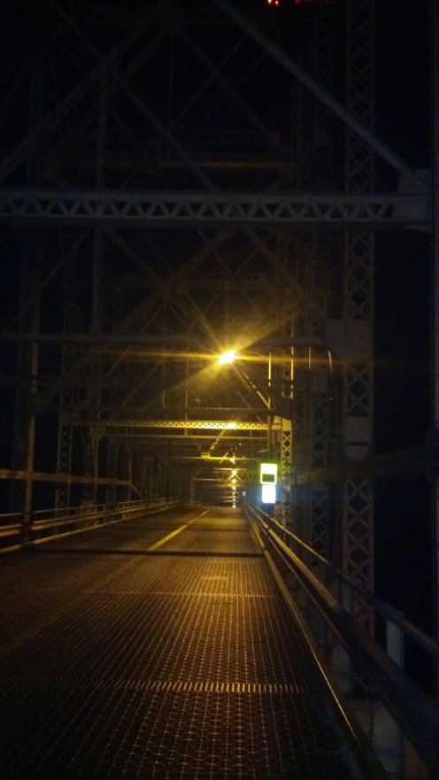
I cross the Bridge of the Gods at night. Halfway across I pay tribute to two of my heroes. Spencer, who in a moment of inspiration created a family legend on this bridge, and to Charles Lindbergh, who once flew a plane under this bridge. Because he could, and he was cool.
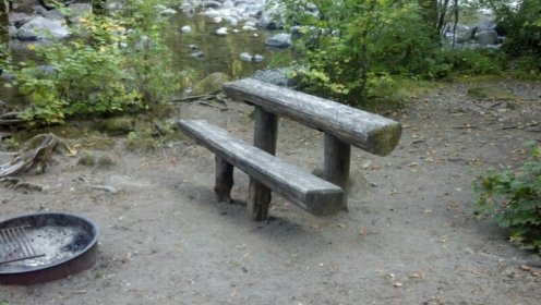
Well designed picnic table in the middle of nowhere.
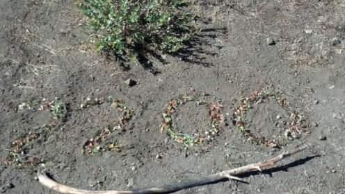
Miles just keep rolling by. It took me forever to collect those flower tops from a relatively barren ridge.
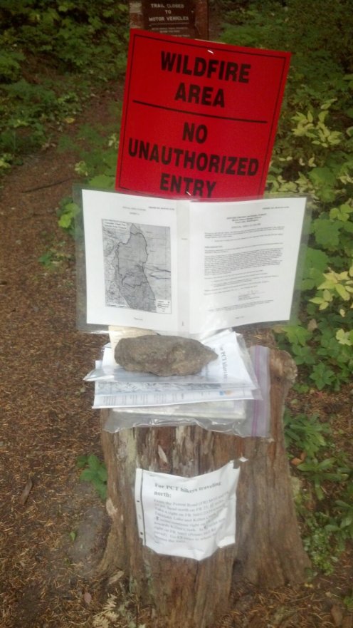
Fire closure just outside of Trout Lake. I get a ride over the 20 mile road walk detour and pick up a day in the schedule. I slept just inside the restricted zone, cowboy camping for perhaps the last time. Russell met me the next morning and brought me my tent. I tried to hitch for 2 hours before dark the night before. The only person to stop was a forest ranger who could not give me a ride, but said she just could not drive by without making sure I was OK. She did give me some food, which was sorely needed. I was down to one mac and cheese for dinner and breakfast, about 1500 calories short. When we went to town in the morning, we learned it was 29 degrees over night.
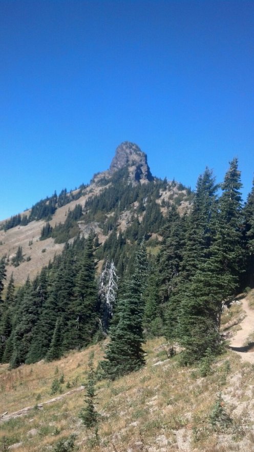
Center core of an unnamed volcano. The lava inside the throat would have cooled more slowly and therefore be harder. The softer outer layers of the mountain have since been eroded away.
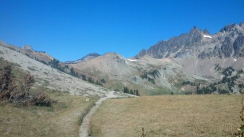
The trail rolls on just above the timberline and I get the first glimpse of snow. It’s all leftover snow from last season, which wasn’t all that long ago at this latitude.
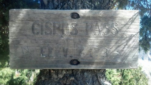
Daughter McKinley went to a camp of sorts near the Cispus river in about the 10th grade. I volunteered, trying to be one of the cool parents. Later I filled my water bottles from the Cispus River headwaters, drinking in the good karma.
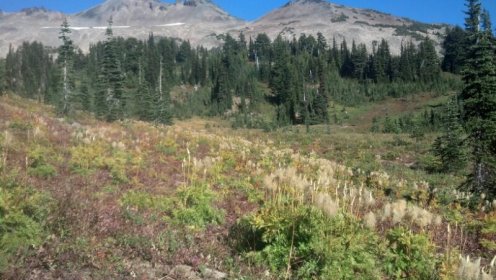
Way more variety in the flora as I move North. The puffy white things I see for the first time. They may be snow grass, as I am in snow grass meadow.
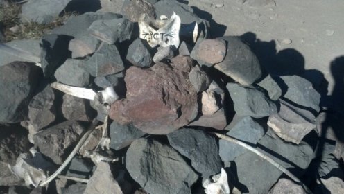
Some trail art. It is not unusual to find old bones artfully arranged at a campsite.
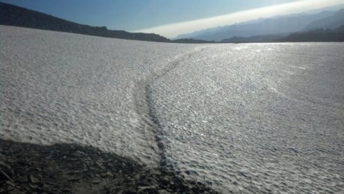
A few snow fields to cross. Thought I was done with this sort of thing.
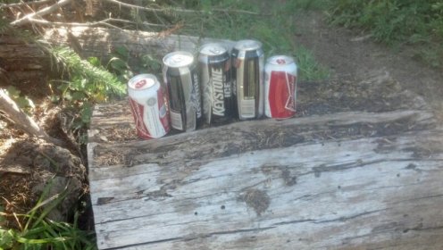
Trail magic! Just sitting on a log, waiting for the next hiker to go by. Later an elk hunter leading 4 horses would throw me a Coors Lite.
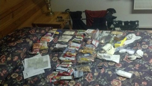
5.4 days / 99 miles worth of food and paraphernalia laid out. Life is good when you have you’re own personal quatermaster. Laundry drying in the background.
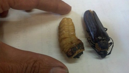
Larvae and beetle from the local forest. This one only eats dead Douglas Fir, and shows up a few years after a fire. Others are Hemlock specific. These are the OK type. Others attack live trees.

I’ve seen a million types of mushrooms, but this may be the first time I spot what my mushroom picking friend from Southern Oregon told me to look out for.
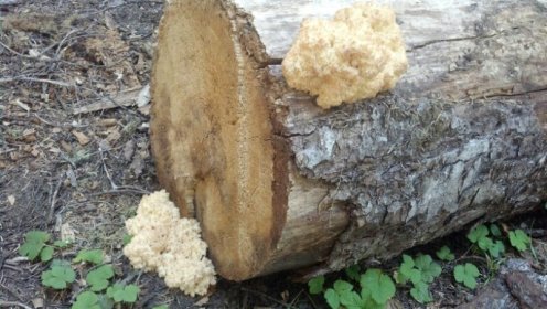
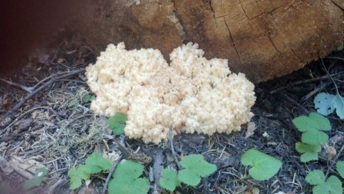
This variety looked exactly like soft coral.
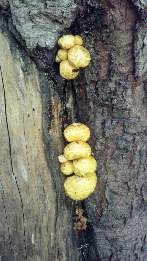
Another of a thousand types of fungi.
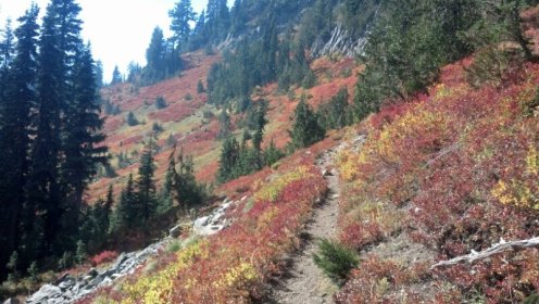
No mistaking this is a season of transition. The most flamboyant are the vine maples.
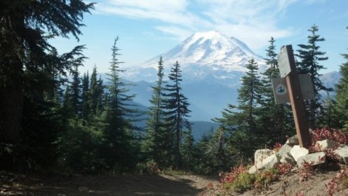
First good view of Mt. Rainer. I peed on top once, and it almost cost me my toes. But that’s another story for another time. I’ve just recently skirted Mt Adams and Mt St. Helens. This is about the furthest north of my past roamings. From here on in it’s all new territory for me.
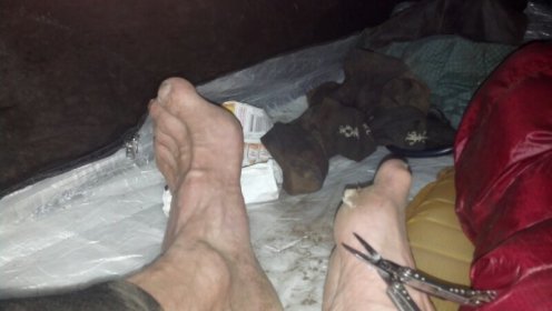
Just giving my feet some love. Finally they are in great shape and the daily mileage is going up. Just trimming away some dead skin from a former blister here. The only thing I do now beside cleaning and the daily massage is to apply good old fashion bag balm. When I showed this to my latest podiatrist he had to laugh. He said when he was a kid, that was his father’s answer to everything. “Put a little bag balm on it”. Must of been a farmer. My standby all all things external was alloa vera.
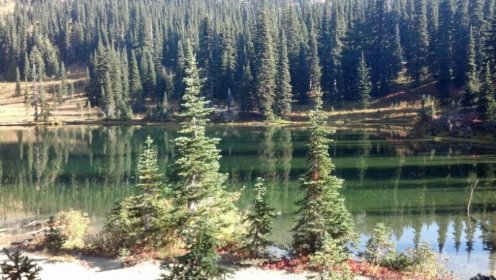
All in all I prefer the green lakes of the Evergreen State to the beautiful blue waters of the Sierra’s. Things are softer and appear more in harmony here. In the Sierra’s part of the beauty was the sharp contrast between water and surroundings. Maybe it’s just me. In both cases the water is absolutely clear and is reflecting it’s surroundings.
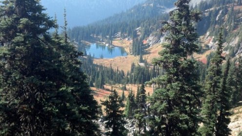
Same lake 20 minutes later.
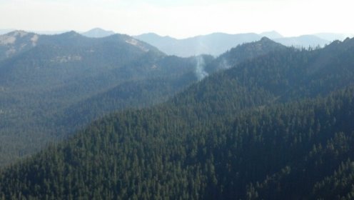
One of several forest fires in the distance. No activity associated with it, so it is probably in the category of ” .. just let it burn, it’s natural. The snows will eventually put it out..” I could see the fire front from the fire just outside of Trout Lake. It was interesting that the flame front followed along the ground, rarely igniting the tree tops.
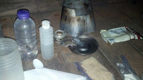
Shared a cabin with a Southbound hiker and some of the local “residents”. This was the first and the boldest of my new roommates. I took all of the day’s food wrappings and left them in a corner as decoys. The rustling went on well into the night, until I just tuned it out. Seeing one crawl up the cabin wall was too much for my human roommate, however. In the middle of the night she couldn’t take it anymore and set her tent up outdoors.
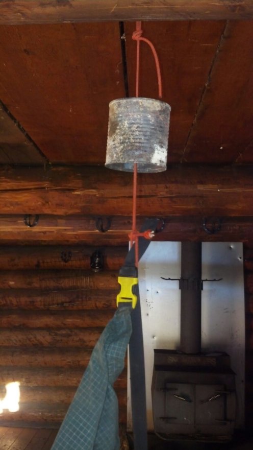
I hung all my food from this simple mouse baffle. No sign of molestation in the morning, so either the decoys or the baffle worked.
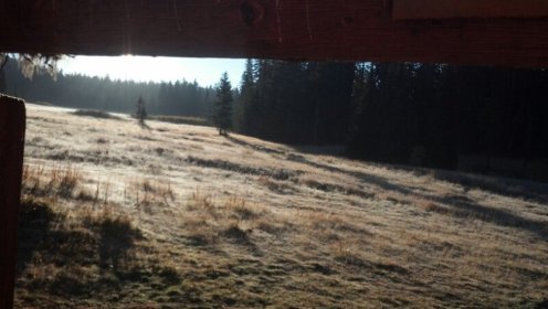
Standing on the porch of the cabin in the frosty dawn. I could just imagine being here 100 or so years ago. Looking across the same meadow, I’d be thinking either: a) I hope something comes by so I can kill and eat it, or b) damn, we need more firewood it’s getting cold!
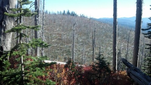
Turn the corner and suddenly I’m in a forest of skeletons.
For many miles I’m in a section known as ” The Knife’s Edge ” . It is some of the most dramatic and exposed hiking to date. It is in the middle of three days of seriously cold and brutal wind, so I rare take out the camera. For a long while the trail is as close to the edge as you can practically be. You can see it just following the ridge, putting the Crest in the Pacific Crest Trail.
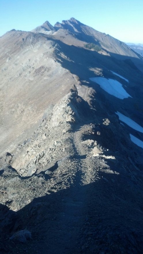
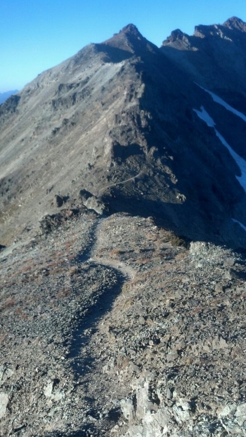
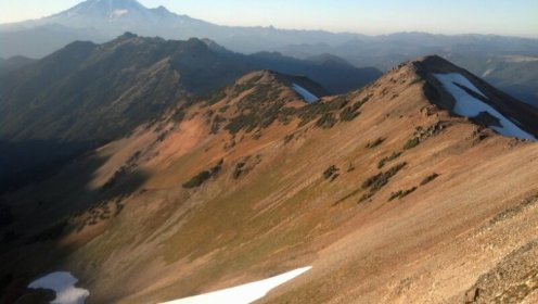
This is the continuation of the ridge walk from the previous photo, colored only by turning the camera toward the setting sun.
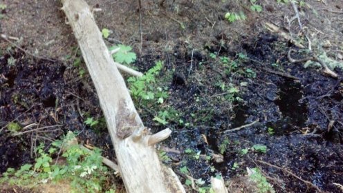
I follow the notes to find this off trail water source, just a muddy bog. But it’s water, and I’m out. It’s been miles since the last water. The walking is not so bad because it is mostly along the ridge lines, but that also means dry. I’m just about to dip into this when I notice the trail continues through the brush and around the bend.
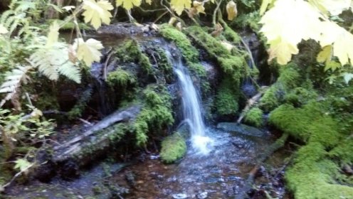
This is the real spring, just a little ways further.
The night before I’m hiking after dark with my headlamp, and I see on and off the trail is littered with what I first think is straw, or hay from the horse traffic. I later discern it is cutting from a native plant.
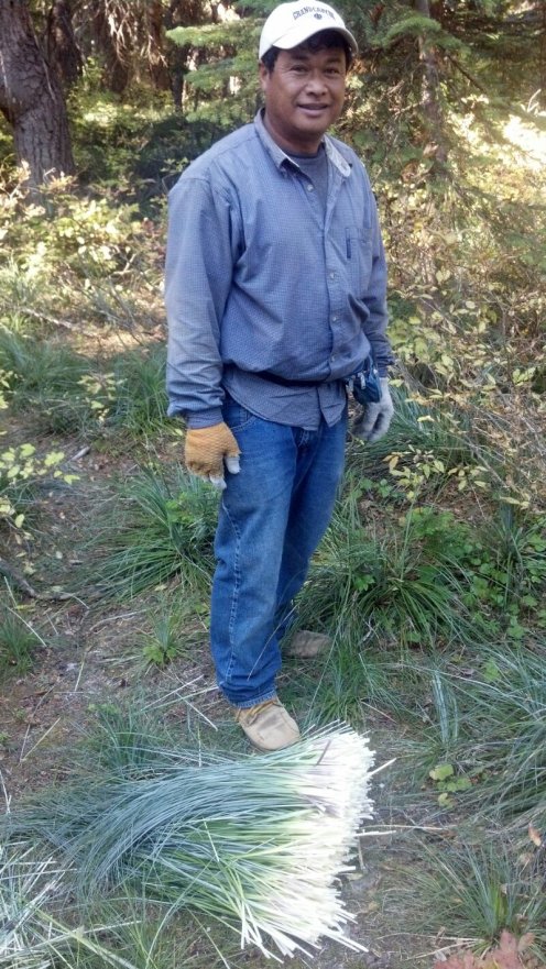
Next day a run across two guys. What they are picking are these sturdy straight leafs. They say they go to the florist trade for dried decorations.
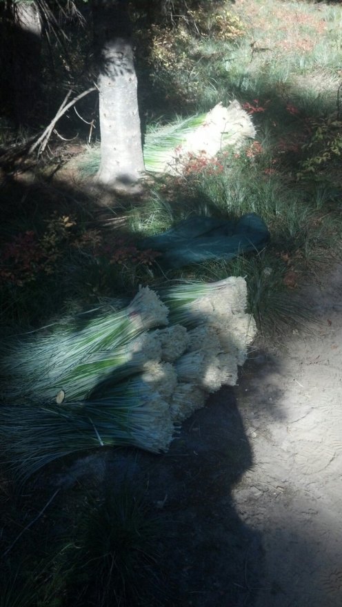
Harvest ready for transport. I’ve been seeing the cuttings for a couple of miles, so they probably picked a mountain load.
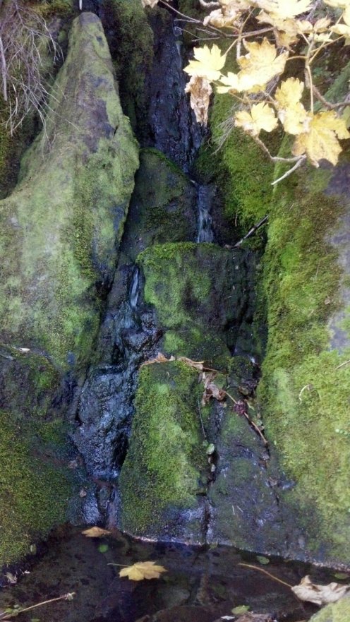
After a long dry section I come across this little waterfall. Ice cold and crystal clear.
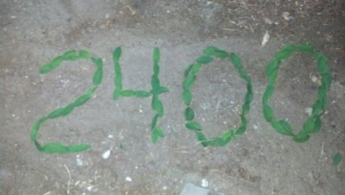
Not many of these left to go. Almost halfway through Washington, and 90% of the trail complete. Currently at Snoquamie Pass, mile 2402. It’s raining outside, and the main reason this quick update is so verbose is because I am procrastinating putting on the rain gear and getting going. 5 days and 76 miles before I get a chance like this again.
For those of you Gentle Readers who have been living life vicariously through this journal, you’re probably wondering what you’re going to do when this journey is complete. Believe me, I’ve been thinking about the same subject. Trust me, I’m working on a plan,
The last thing posted here related to crossing into Oregon, now I’m only a few moments away from stepping onto Washington’s volcanic soil. Simultaneously a high and low point in this adventure.
I’m looking at Washington as the last hurdle. Just one little 500 mile or so sprint. Excited to have the end goal in site. Today we packed the last food bag and ripped the last page out of the guide book. Two days rest, reconfigured my gear, gained back 6 pounds, got my feet tuned up and I’m raring to go.
Got off the trail in Cascade Locks, Oregon. When I get back on, the first few steps will put me on the Bridge of the Gods and over the Columbia River. At 235 feet above sea level, this is the trails lowest elevation.
The only dark clouds on the horizon are the dark clouds on the horizon. I think it’s going to come down to a race with the calendar. It’s all up the Snow Gods now. On my end, I’m now packing a heavier tent and some serious new rain gear. I’m not giving up without a fight.
Lots of good stories coming out of Oregon. Mile for mile it was more beautiful in general than California. Flatter and faster as well. 20 miles per day was pretty much the average. But the mornings were cold and the days getting shorter. Town stops were further apart and in general I tried to get in and out as fast as I could. Hence no time to write. But don’t think I haven’t been thinking of you gentle readers.
I’ve meet so many characters. The mushroom hunter, the plumber, a Nick Manwell clone and an elk just to name a few. Spent most of the time in Alpine meadows, where Spring and Fall occur almost simultaneously and Summer as we know it just does not exist. Crossed four snowfields in one day. Something I thought was both well behind me and way in the future.
So much to share, as good to hear as it is to share. A few choices for you, gentle readers. Either check back here from time to time, drop me a line via comments, or come out and meet me on the trail.
Only 29 trail days left. Then what?
Several of you Gentle Readers have stated a familiarity with Short jokes.
No matter where you are on your personal security scale, you have to admit we live in a time and world where it is much less likely that our sons and daughters will ever end up reciting Short jokes. It’s up to us old timers to preserve this lexicon.
Send me what you remember and I’ll collect them here. Some recent contributions:
I’m so short…
..I could parachute off the edge of a dime
..I need a T-10 just to get out of bed
..I can wear a top hat underneath a snake’s belly in a wagon rut.
.. I can do pull-ups on a staple.
..When I sit on the ground my legs dangle.
At long last. Oregon. Sounds so good just to say thy name: Oregon. Even has one less syllable to make it go down easier.
California does not give up without a fight. I leave Seiad Valley just outside the fire closure line. Smoke and Technicolor sunrises/sets are my constant companions. Seems like I’m going up and down continually for no apparent reason.
Things are clearly changing. Not just the trees but all the ground plants are looking more like my adoptive Portland based reference woodlands. That is until you go around the corner and the scene switches back temporarily to when-will-it-ever-end California.
No matter what the map so emphatically promises, CA just seems to just go on and on. There are no geological, historical or otherwise cool points between here and the border. CA has only one job to do, and that is to be over.
I’m making pretty good mileage, often in the 22 – 25 miles range. It is definitely getting dark earlier, and I am definitely not getting up any earlier in spite of my best intentions. I’m walking later into the dark. One night I hit water and a good campsite after 20 miles. But it’s still 45 minutes till dark. I push on, Oregon here I come.
It’s a long gentle canyon that seems to go on. For sure it goes on past dark. I’m doing the no flash light dance until I finally top out. It’s in the trees and dark dark. Steep downhill to follow, so it’s either flash light up from here or camp. I hunt around in circles for awhile and dig in.
Up and out early the next morning. Fresh and moving downhill. In 45 minutes I’m back at the water spot, a distance that cost me an hour and a half the night before. In the daylight I walked out of camp in the wrong direction. Come on CA, give me a break.
And then seemingly out of nowhere, in a nondescript turn in the trail is a point where it is assumed a line first described by words then by pen corresponds to the dirt on the ground. I linger, take pictures and write in the journal before I cross over.
I step over deliberately, just once. No back and forth for me. First California, now Oregon, then North.
Just a mile or so to a road junction where I’ll camp. Along the way I meet a guy looking for his son, Bouncer, who must be just behind me. Seems Bouncer’s Mom and Dad, sometimes with a much younger but perhaps traditionally named Bouncer sectioned hiked OR and WA years ago. Bouncer, now 19, is thru hiking, with the family following along this section with a camper.
I camp by the road junction and it is cold. Still no tent. That is my first real impression of Oregon, cold.
At some point Bouncer shows up and I hear all the hooping and hollering from the other side of the bushes. At one point I hear: “At last I get my husband back!”. I’m not sure if Bouncer is married or this refers to the obsessed Dad.
A day or so later I do 26.2 miles, a personal best. I’m in Ashland. And this is Oregon for real. And for the not so real.
Some scenes from the trail:
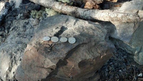
In my haste to catch the ride out of town I broke one of my cardinal rules: “Always dump your change”. Here I leave the leftover quarters from the Laundromat at camp.
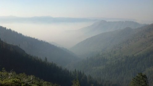
Smoke highlights the 3-D nature of my universe. Fortunately the air is clearer at higher elevations.
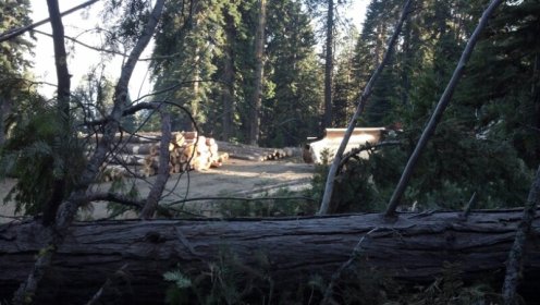
I pass through an active logging site. Here are some locals waiting for that great one way trip of a lifetime.
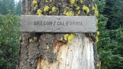
How do you spell “Understated “?
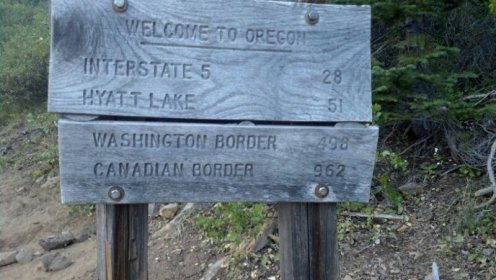
Suddenly it does not seem as far as yesterday.
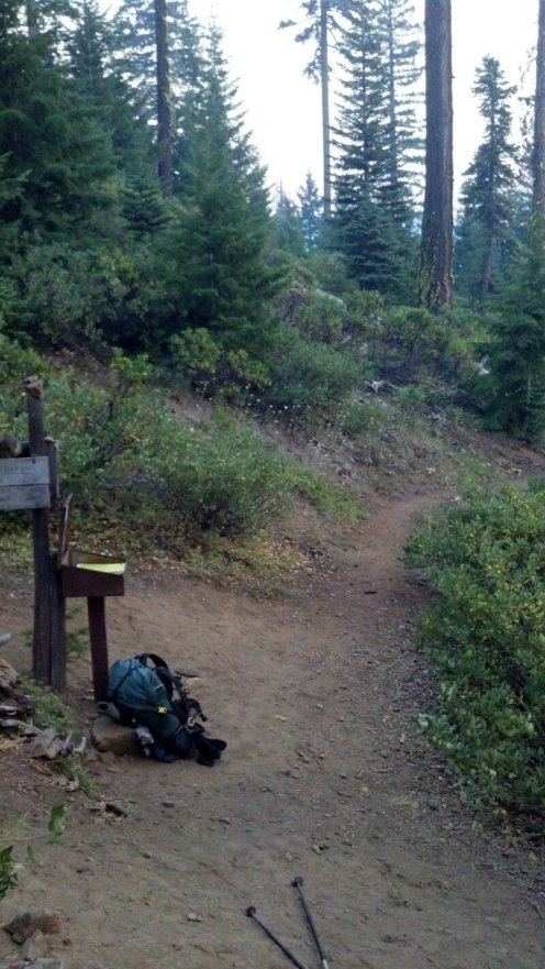
One last look back and then goodbye, California.
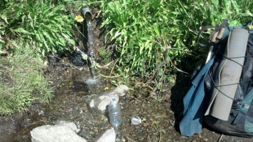
First water in Oregon. A spring right out of the rocks, piped for easy access, wild flowers and honey bees. Right on the trail. Perfect.
Don’t let this little piece of aqua heaven fool you, as it did me. The next 200 miles of Oregon were drier than any stretch in CA. More on that later.
I’m coordinating a visit with Kim. She is going to meet me at some point where the trail cross a road. Targeting Hyatt Lake. Because of this, I’m using my cell phone in the middle of the day, a rare occurrence. I’m stopped by a water source. Several other hikers show up and plop down in the shade for lunch.
While this is going on, I get an email from Russell the Quatermaster. He has been playing Trail Angel to Alex, Dan from Florida, and two other friends. They are basically the whole State of Oregon ahead of me.
Now this may be the first time you have seen “Russell” and “Angel” in the same sentence. We’re talking about Angeling, the verb, not Angel, the noun. The only people who ever thought of Russell as Angel the noun are either now Octarians and of questionable memories, or are finally Angels for real and probably know better by now.
Anyway, in his capacity as Trail Angel he shared these thoughts from the Group W Bench. (Being a certified Draft Dodger, the Group W Bench is something he is a relative expert on.) This is from Russ’s email:
Group W Bench
Today I took some PCT hikers to REI downtown. I browsed for a bit and then took my preferred shopping position which is on the nearest bench or chair waiting. This particular bench was near the front door so I had lots of opportunity to observe the comings and goings of REI patrons. One person who caught my eye was an old dude like me on his exit from the cashier’s area. I noticed him because he was tall, broad and had long gray hair. (Not what you’re thinking here ok?) He was wearing cut off jeans and as I scanned down his long legs I thought it odd that he was wearing, what appeared to me to be, women’s sandals. Not that there’s anything wrong with that! But then as I looked closer I noticed that his toe nails were painted bright red.
A bit over red line on the weirdometer for me.
Back to the water source. One of the guys I’ve been seeing off and on for the past two weeks is here, named Neon. His toe nails are painted in neon colors. Each a differ shade. I did not know there were that many neon colors. And in no way do the toe nails distract from his general fashion motif. According to trail scuttlebutt, he just left NASA after 27 years of service. I guess if I worked for the same company for 27 years, I’d want to let my Freak Flag fly as well.
Red toe nails in Portland? Let’s Keep Portland Weird. During lunch at the water source, in the course of general conversation, were heard these words: “Let’s keep Oregon neon”.
So where do think those people on the Group W bench came from?
